
Social Trail Savvy: A Guide for Protecting Sensitive Ecosystems
Think back to the last time you were hiking a trail or visiting a local park. Did you ever stop and say to yourself: “What natural wonders may I discover if I just…step foot off this trail and wander into the forest?”
Most trails within public spaces are designed to guide visitors from one location to another efficiently and to provide safe access to natural features. Most parks advise hikers to keep on the trail, but what if there is a natural feature you want to check out that is not accessible via a developed path? What actually prevents me from taking the road never traveled, and why is the park telling me to stay on the path? It looks like someone’s stepped off the path there… What’s the big deal if I’m just one more?
Let’s talk about it.
What are social trails?
Social trails are unofficial paths that people create when they veer off of an established trail, formed over time by a lot of foot traffic.
You may have seen a social trail if you’ve come across a field that appears to have flattened grass, or hiked a switchback only to see a path cutting straight through to the top. These trails are not planned, but they can form from hikers taking shortcuts or trying to reach something that seems interesting off the trail.
Impacts of Social Trails
Social trails leave lasting impacts but unfortunately are quite common. This National Park Service article identifies some of the problems associated with social trails.
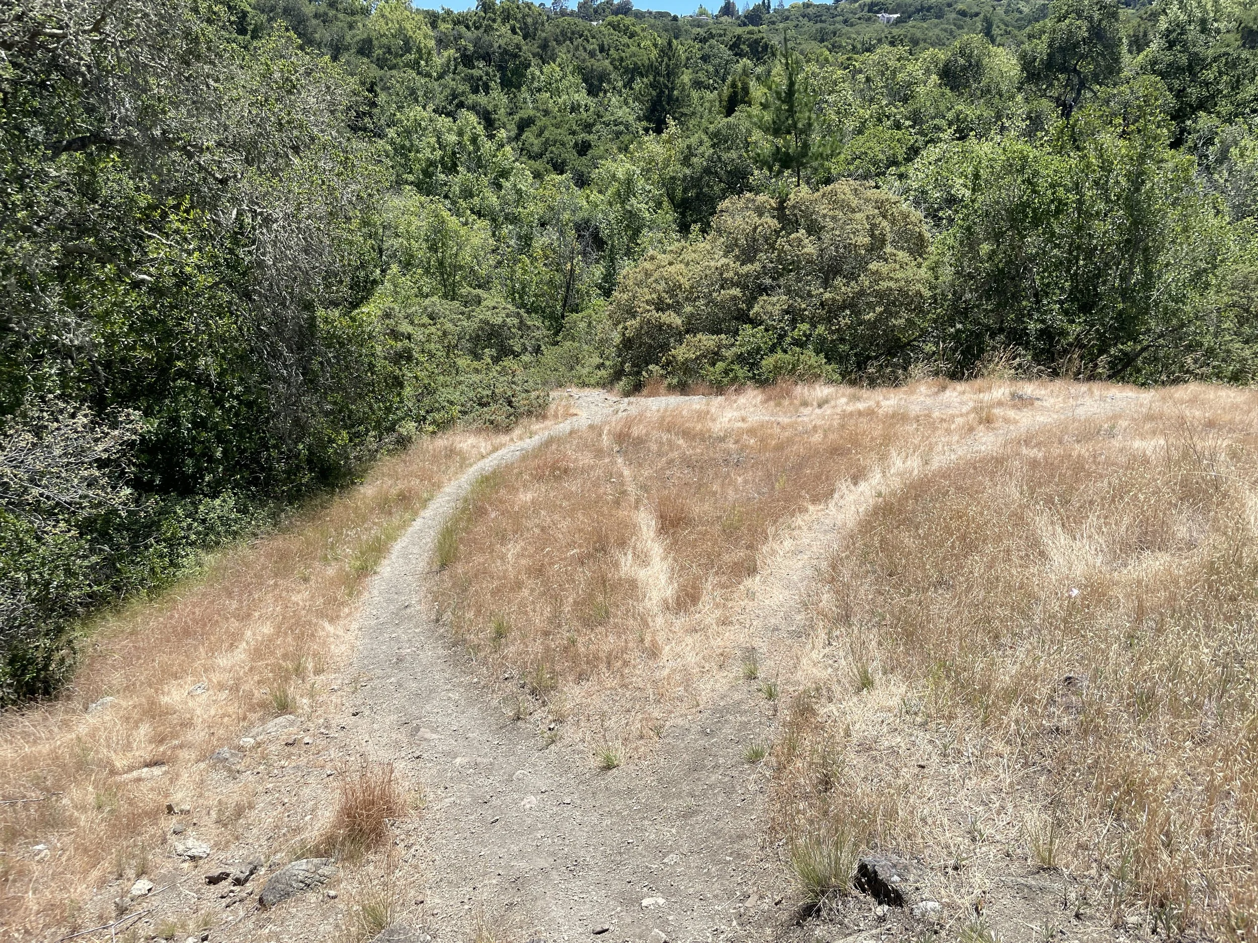
An established trail on the left with social trails on the right as shortcuts to another trail.
Social trails can:
Harm plants and wildlife
Lead to habitat fragmentation (according to this study)
Increase erosion, which contributes to further degradation of habitat
Confuse and disorient hikers due to many trails not being on a map
Stulsaft Park: A Case Study
Stulsaft Park, a 42-acre park nestled in the hilly suburbs of Redwood City, is a part of Grassroots Ecology’s web of habitat restoration sites across the San Mateo and Santa Clara counties. Complete with picnic areas, playgrounds, off-leash dog areas, and miles of trails, the canyons, creeks, oak woodlands, and grasslands of Stulsaft make for an excellent choice for recreation not far from urban hustle and bustle.
Stulsaft Park has just under 1 mile of social trails. If a path was laid across the length of the park, you’d be able to walk from one end to the other and back!

Trail data was recorded using the running app Strava on a mobile device, then exported to QGIS where the map was created.
The map above depicts the network of trails present throughout Stulsaft Park, classified as official and unofficial based on a few criteria: (1) presence of official trail markers, (2) distinct pavement and lack of vegetation, (3) and presence on map services such as Google Maps. As the map shows, people and dogs have created many social trails at Stulsaft Park.
It is important to keep in mind the impacts these unofficial paths have on Stulsaft Park’s unique habitats.
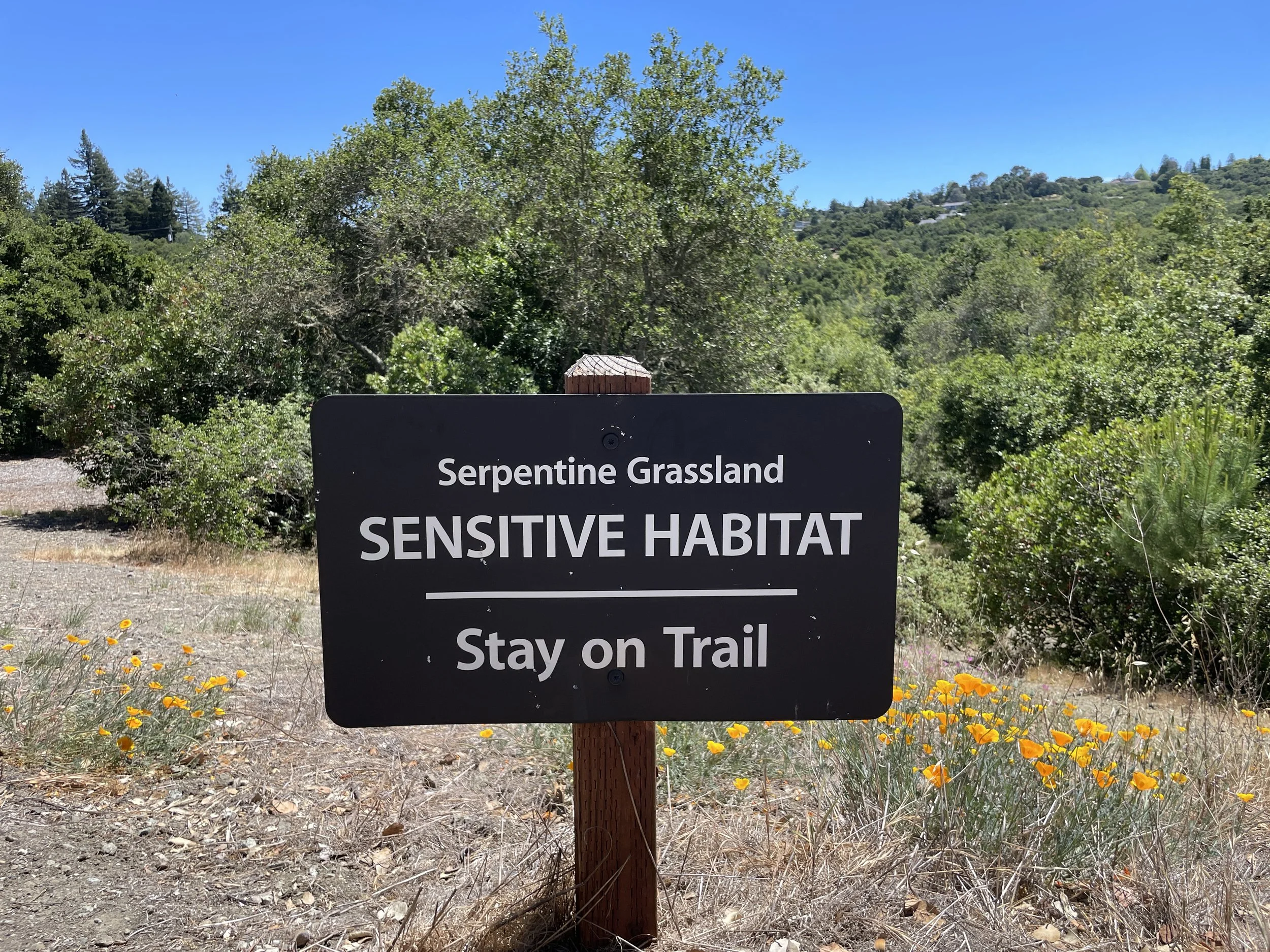
Half of the park is located on serpentine soil, a unique geological feature of the region that hosts rare and endemic species such as the Franciscan onion (Allium peninsulare) and leather oak (Quercus durata). These plants thrive in this uncommon soil type and are rarely found anywhere else! The reason this side of the park requires dogs to be on a leash is to protect these sensitive species.


Franciscan onion and leather oak are both endemic to California. Franciscan Onion is only present in the San Francisco Bay Area, and the leather oak’s range is almost entirely restricted to serpentine regions!
On the other hand, the area of the park south of Arroyo Ojo de Agua is leash-optional due to no rare or threatened species. Instead, we have our more common California Native plants like Toyon (Heteromeles arbutifolia) or Buckeye (Aesculus californica). These species are more adaptable, yet they can still use the same TLC (tender love and care) as our serpentine friends!
When travelling off an official maintained path, hikers and dogs run the risk of damaging sensitive and native species. All that activity discourages the growth of native plants and habitat integrity.
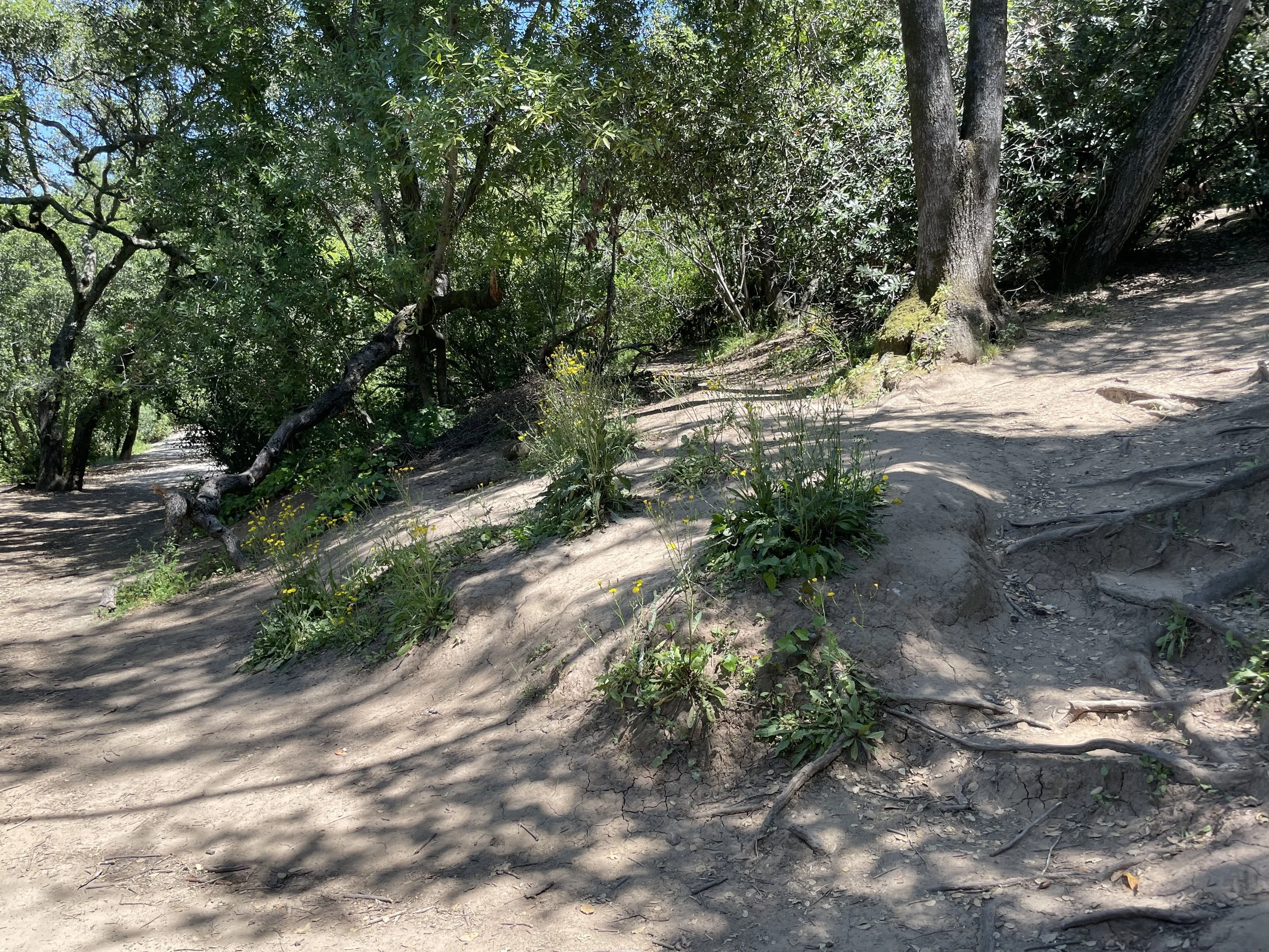
Social trails may look less like distinct paths, and more like this area near the Silver Hill entrance. Frequent usage has hardened the soil, exposed tree roots, and enabled nonnative species to take hold.
Who’s with me!
We get it. When the woods are calling to you it’s hard not to go off and explore your own way. Now that you’re armed with knowledge, you can make your own informed decisions when heading into the great outdoors!
Become familiar with your park’s rules. They inform you of why restrictions are in place, for the safety of natural resources and you as well! When the park informs you to keep your dog on the leash, it’s for reasons like safeguarding habitats.
When approaching a trail that looks social, the best practice is to avoid using it and stay on the official path. The same goes for your pets; area-specific rules are there for a reason. You’ll do your local habitat and ecosystems (and our restoration projects!) a huge solid by following these guidelines.
If you were a woodrat, wouldn’t you feel safer knowing that you can travel from one tree to another without revealing yourself to a coyote through a clearing? Or imagine you’re a deer. It would be pretty nice if you came across a delicious Coffeeberry (Frangula californica) bush that wasn’t trampled by an intersecting social trail. Official trails are designed to resist erosion from heavy traffic, maximize habitat connectivity, and make our local wildlife safe and happy.
Now that you know more about parks and what we do to preserve them, thank you and happy trails!

A branch off a formal trail showing signs of becoming a full-blown social trail.
By Kapewa Hopfe, Habitat Restoration Intern
